Fire Volcano Tour
Fire Colima Volcano Tour
10 hrs. aprox. Monday to Sunday (Except in red alert)
Available in English and Spanish.
Available in English and Spanish.
Nature.
we go to your hotel or home address.
we go to your hotel or home address.
Description
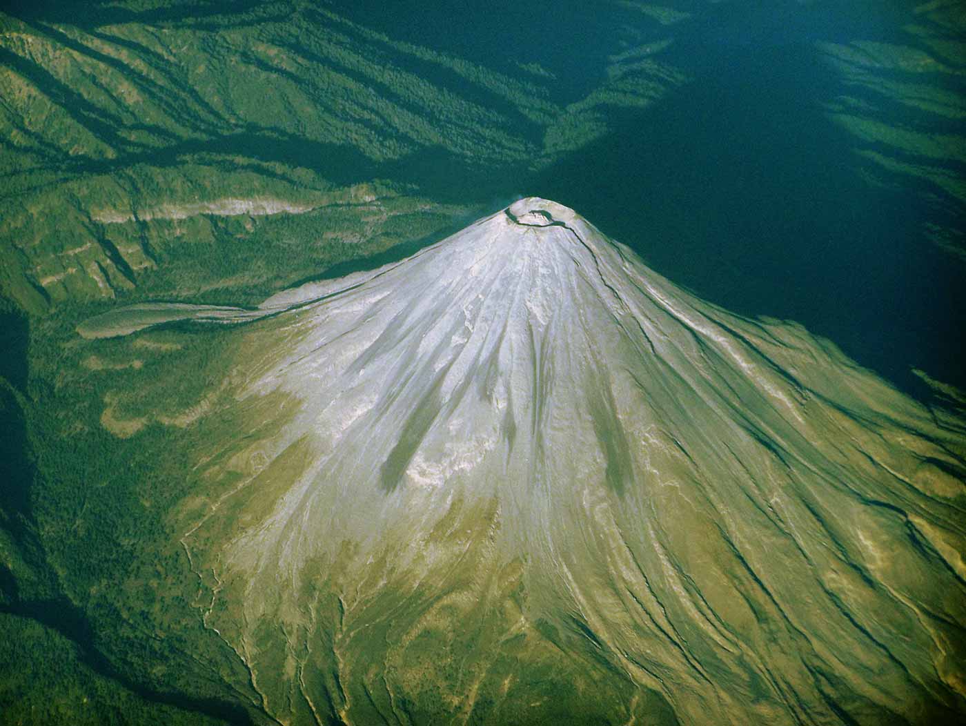
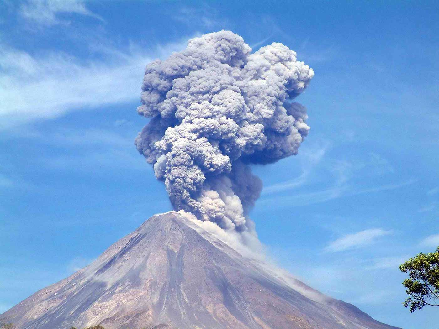
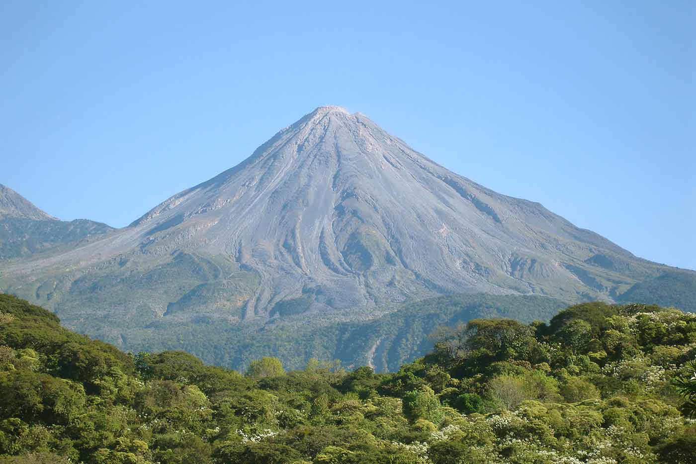
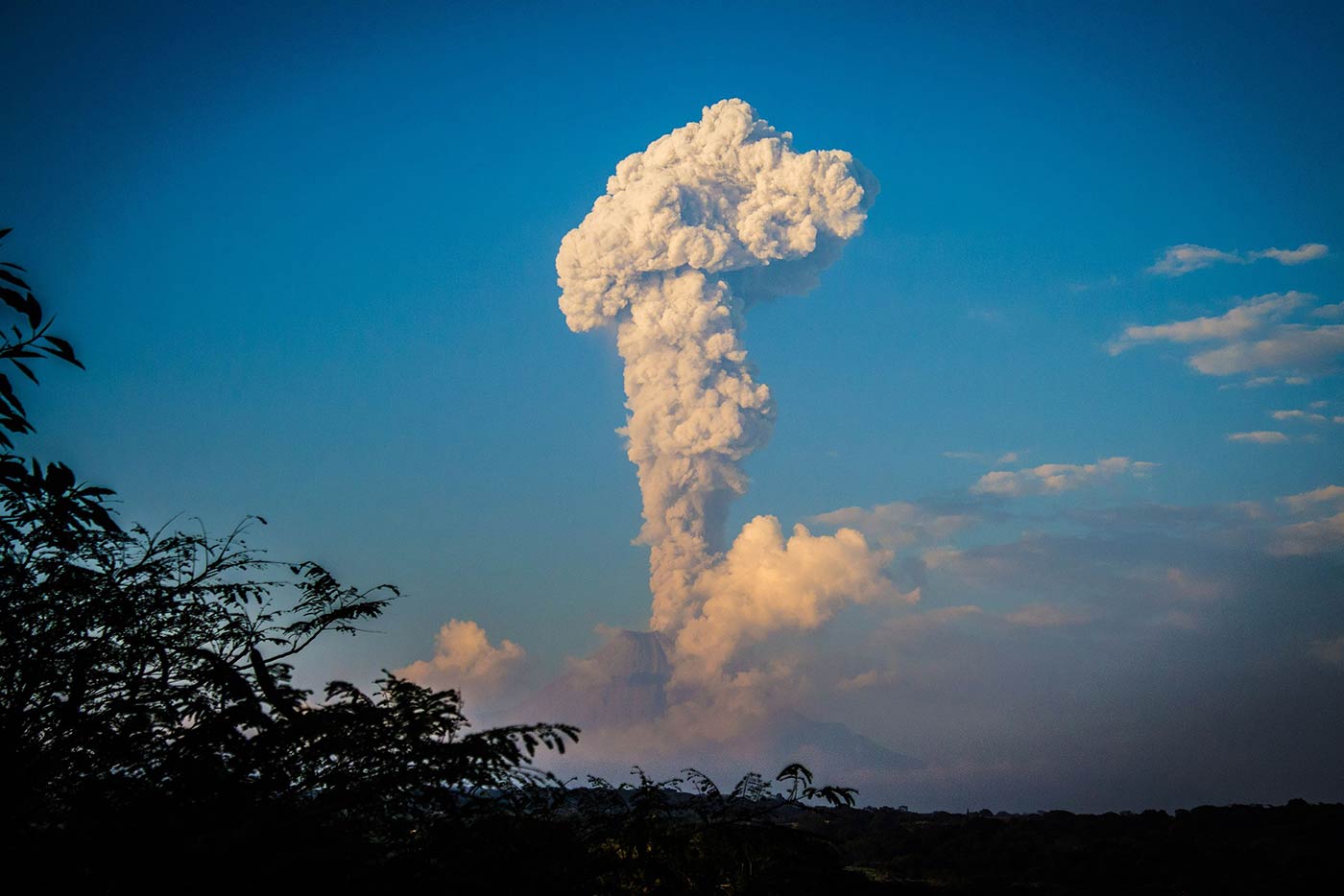
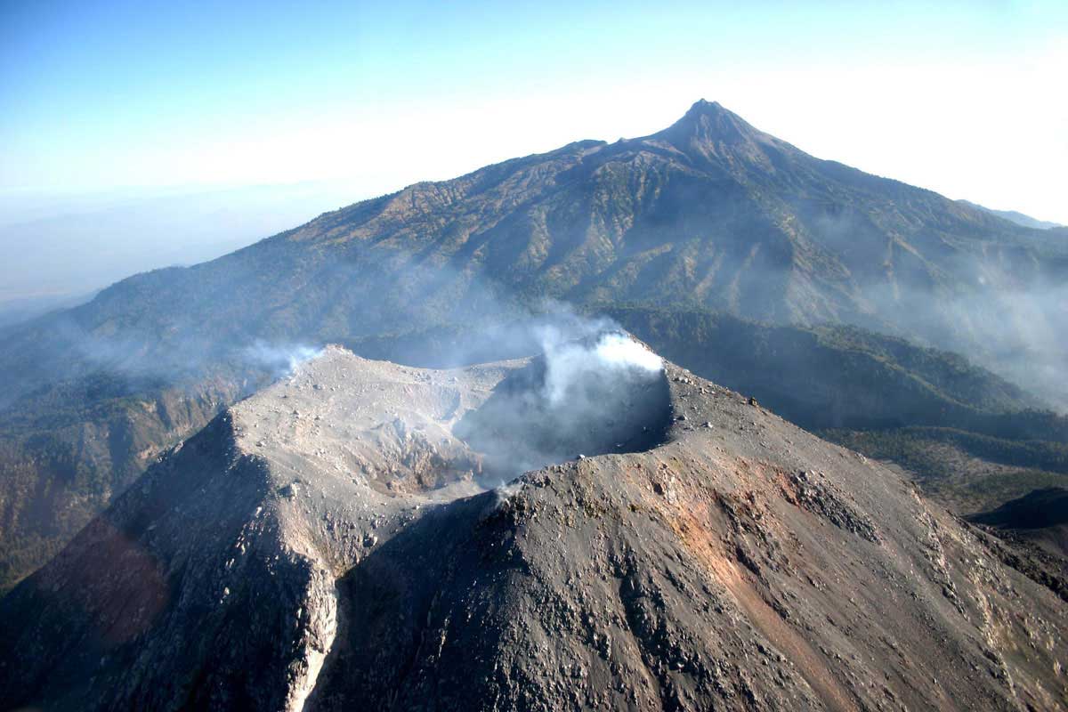
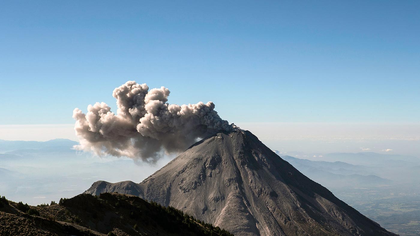
Explore the fire Volcano area (active), wonderful wild life, rich in flora and fauna. Enjoy Comala the white painted and red roof tile houses that inspired writers like Juan Rulfo and Grabriel GarcIa Màrquez. You will experience the magic zone. After a traditional meal enjoy a panoramic tour of Colima city.
- Copy of confirmation email.
- Comfortable shoe.
- Sunglasses and hat.
Cancellation or change of destination is accepted 48 hours in advance.
Cancellation on the same day of the tour is not refundable.
Cancellation on the same day of the tour is not refundable.
Itinerary
| Hour | Description |
|---|---|
| 07:30 hrs. | We go to your hotel of home address (previous reservation). |
| 08:00 hrs. | Transfer to the Magical Town of Comala. |
| 10:00 hrs. | Free time in the village to buy crafts. |
| 10:30 hrs. | Visit to the magic zone of inverted gravity. |
| 11:00 hrs. | Transfer to "La Yerbabuena" highest point to appreciate the volcano. Visit to the famous tree "The guardian". Free time to explore. |
| 12:30 hrs. | Excursion to the Magical Town of Comala. |
| 14:30 hrs. | Visit to "Laguna la Maria" located in a crater. |
| 15:00 hrs. | Free time to eat and explore the area. |
| 19:00 hrs. | Start the return to Guadalajara. |
| * Tentative itinerary . | |